This is one of the only places on Earth where you can see two tectonic plates pulling apart. This unique and interesting landscape is a bit of a maze, so here’s a guide to help you plan your trip.
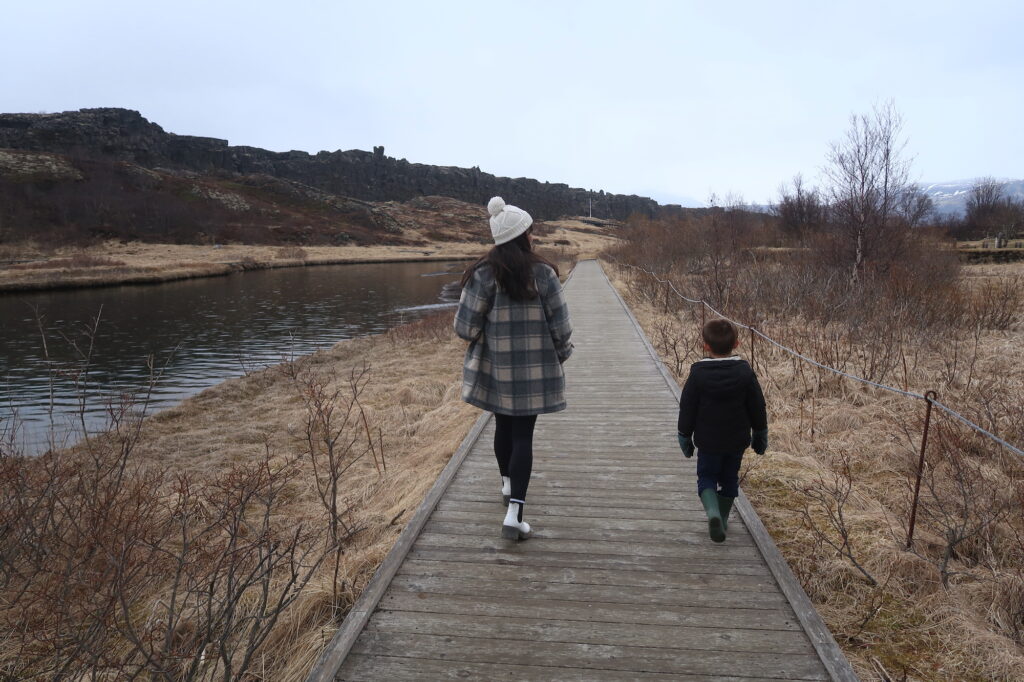
Note: There’s a lot of history here in Thingvellir, from the start of Iceland’s government to its cultural significance. There are lots of signs around the Park for you to learn, I recommend you read them. Or go to wikipedia. This post is just about how to get around and make the most of your time when you visit.
How should you approach Thingvellir? From East or West?
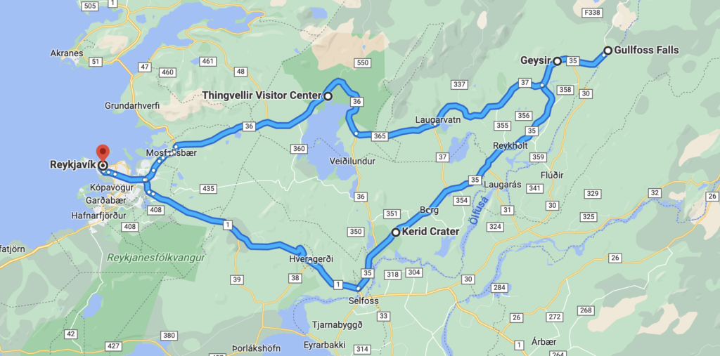
So first, how you visit Thingvellir depends a bit on which way you’re coming from. We came from the East (from Gullfoss and Geysir), going around the Golden Circle counterclockwise. This is the way we recommend seeing the sites on the Golden Circle, since you get the longer drive on the south part out of the way at the beginning. So let’s assume you’re coming from the East (but if you’re coming from the Reykjavik, I’ll put that route at the bottom).
From the East (from Gullfoss and Geysir)
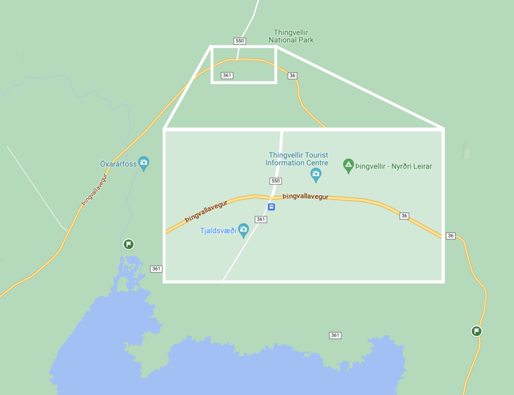
The first thing you’re going to do is stop at the observation point on the East side of the Park on 36. In the map below, it’s the green flag on the bottom right. This observation point is on the edge of the Eurasian tectonic plate, and gives you a great view of the entire Park, as well as the North American tectonic plate on the other side of the valley.
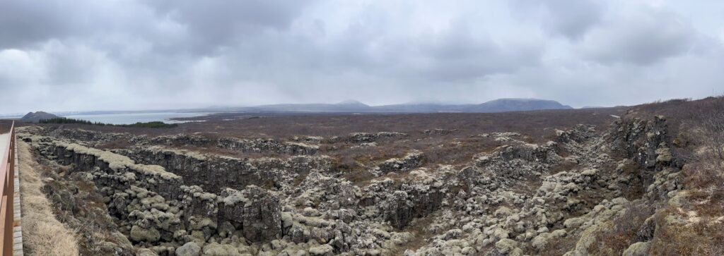
There are signs here; read them. You’ll learn all about the geological significance of this place. Basically, it’s one of the only places in the world where you can see two tectonic plates pulling apart. And you’re literally standing on the edge of one of them. Which is just mind boggling. 🤯
You’ll keep driving until you reach the highlighted intersection in the map below. If you continue straight on the main road, you’ll go to the visitor center. But don’t go that way. Instead, you’ll want to turn left, down onto 361 toward the waterfall (Öxarárfoss).
1. Öxarárfoss
This is the only major waterfall in the Park, and compared to Skógafoss and Seljalandsfoss, it’s tiny. But it’s still pretty and historically important (again, read the signs).
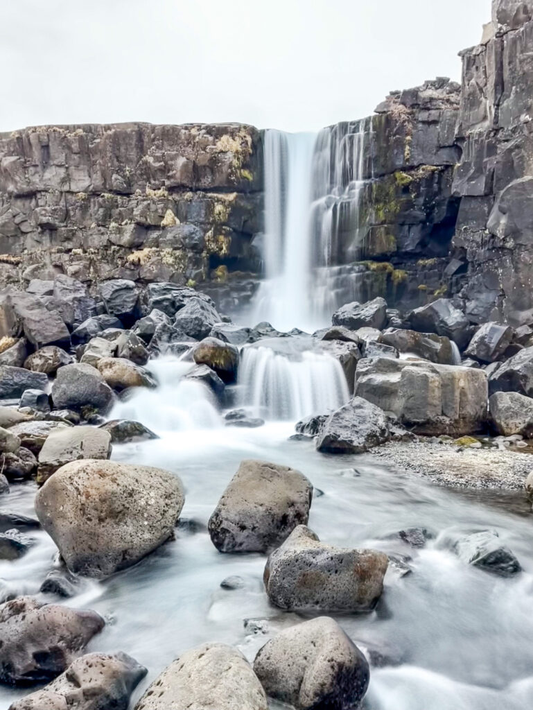
To get to the falls, you’ll stay to the right at the fork and then park where the road ends. Here’s a map that we’ll refer to a few times throughout this post. Öxarárfoss is at #1.
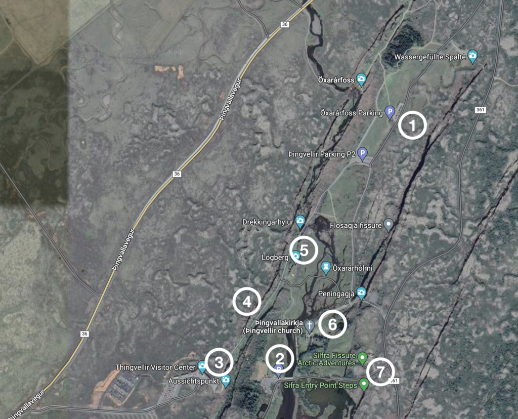
From here, we made the mistake of walking the rest of the way. Don’t do that. Get back in your car and drive back up 362 to that fork in the road, and then come back down 361 and park at the lot I’ve marked with a 2 (P5 on the map below). That’s where you want to be to explore the rest of the Park. Here’s a map of Thingvellir from their site. The roads are in yellow and the footpaths are in red.
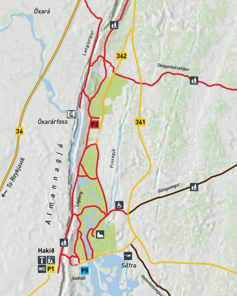
2. Park at P5
Now that you’re parked, you’re going to walk through the map in the order I’ve numbered them. From the parking lot, you’ll see a couple paths leading out into the Park. Take the path that leads toward the observation deck. There’ll be a big ridge in front of you and people will be standing on top of it. That’s the direction you want to head. You’ll walk up some stairs and along a boardwalk. Keep heading toward that observation deck until you get this view:
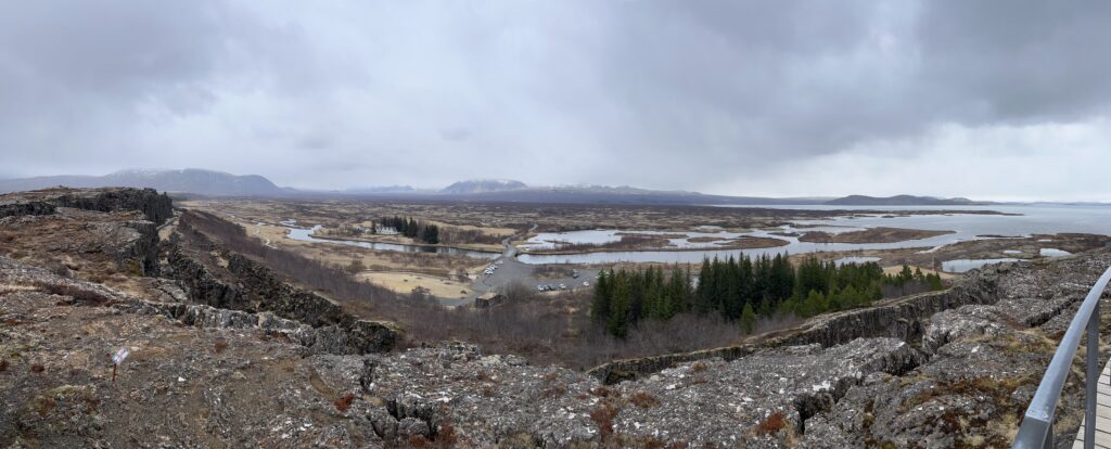
3. Thingvellir Visitor Center & Observation Deck
From this side, you really get to see all the cracks that have been filled in by the lake. These are all cracks that have formed as the tectonic plates have pulled apart. Many in the last several hundred years.
Behind you is the visitor center. There’s not much in there. Just some bathrooms and pamphlets.
Start walking down the boardwalk hill into the ravine.
4. Almannagjá
Walking down this path, you’re walking along the edge of the North American tectonic plate. It’s really hard to wrap your head around this.
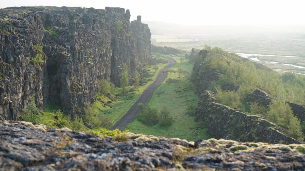
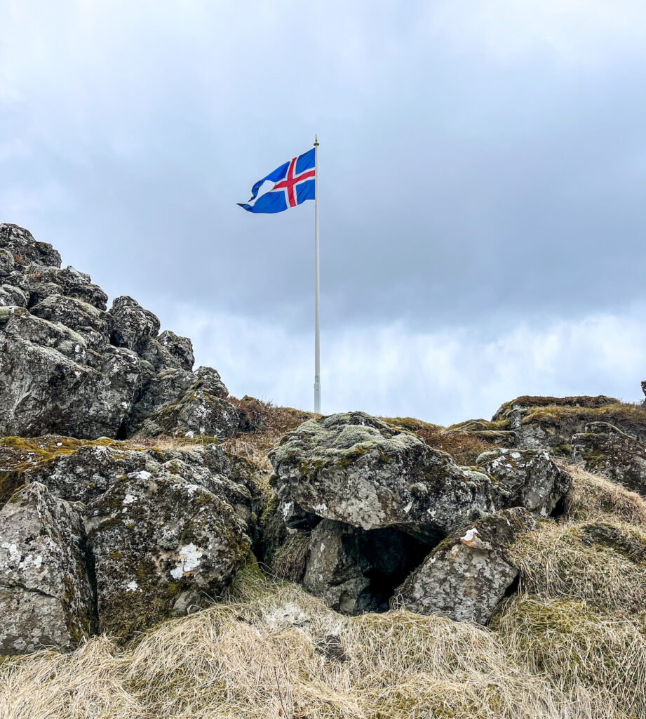
As you walk along this path, you’ll soon see a flag off to your right. Take the side path out to that flag and rocky outcropping. This is Lögberg.
5. Lögberg
This is literally where the original assembly met and formed the government here in Iceland more than 1000 years ago.
This is as far as you’ll walk down the path. From here, take a look out over the valley below and plan the paths you’ll take to get to the church.
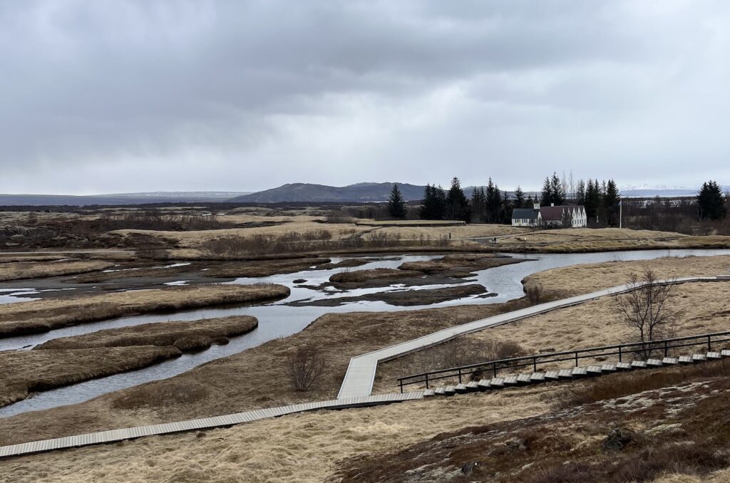
6. Thingvallakirkja (Thingvellir Church)
This isn’t the original church building, but a church has been on this site for over 1000 years.
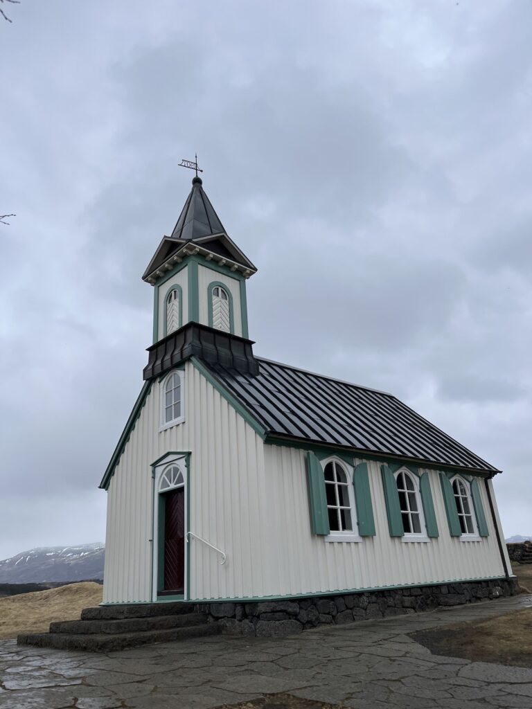
We thought it’d be nice to go in and look around, but it was locked up. But you can look in the windows.
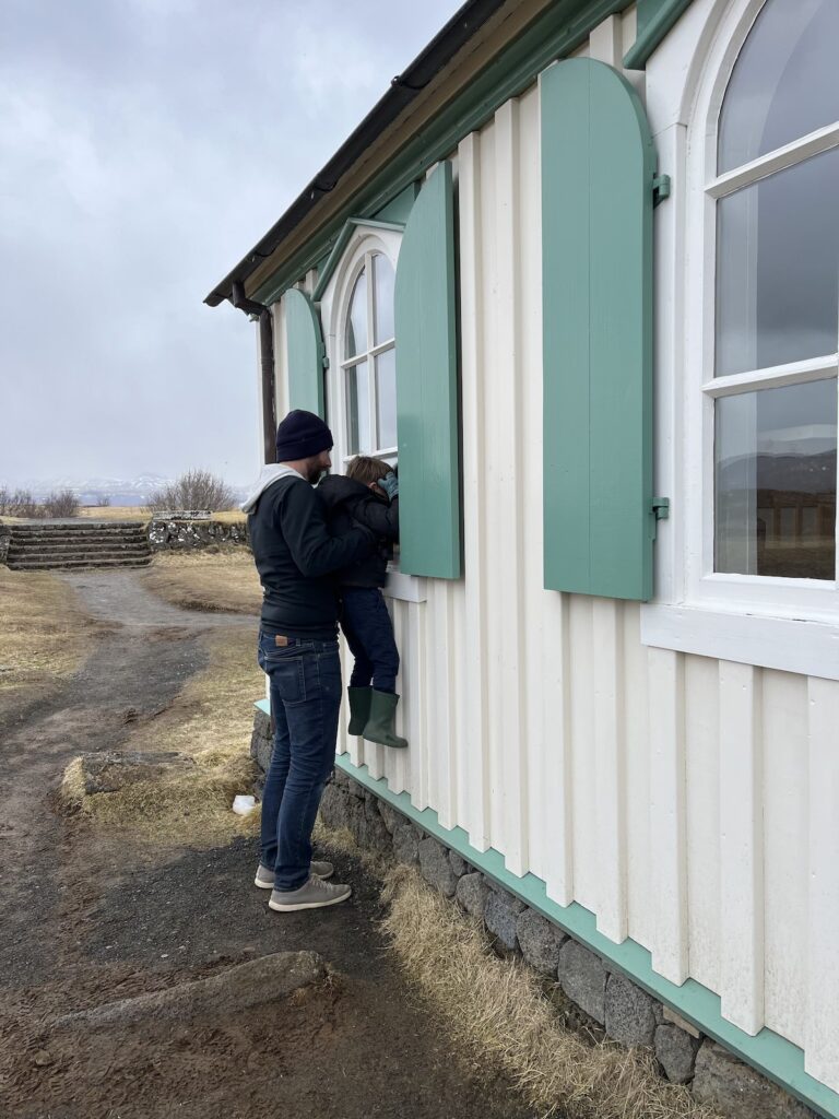
It’s a modest church. Nothing fancy or ornate. Worth visiting for the historical significance, along with the Prime Minister’s summer house next door. You can read all about both of them on the signs.
When you leave the church, walk along the road to Silfra. Some of these roads don’t have sidewalks, but there aren’t a lot of cars driving through here so you should be fine.
7. Silfra
Silfra is a crack that is billed as the only place you can swim between two tectonic plates. They sell it as if the two walls on either side of you are the edges of the tectonic plates. You and I know better, but it’s still cool to see. You can’t go swimming without a group and a guide. Honestly, the water is so cold that I didn’t even want to put my hand in it, let alone go swimming in it.
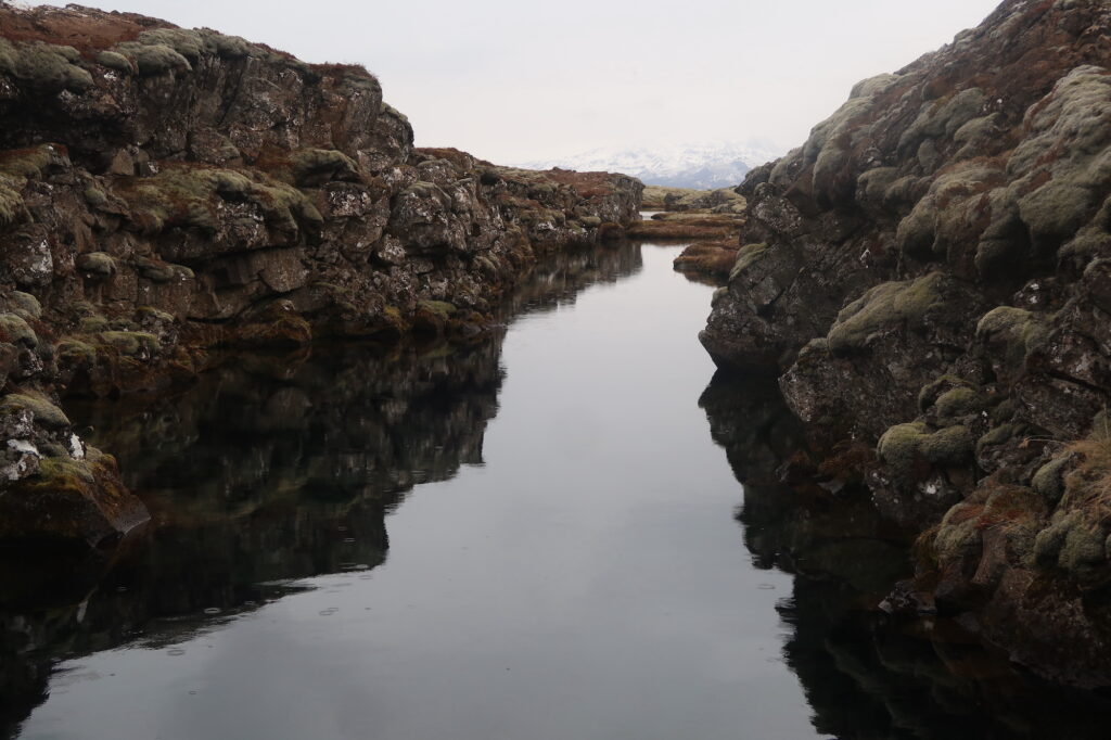
From Silfra, you can walk along the road back to the parking lot where your car is.
Woohoo! You just saw everything worth seeing in Thingvellir National Park in about 90 minutes. Well done!
From Reykjavik
If you’re driving to Thingvellir from Reykjavik, you’ll pull off 36 right into the parking lot for the visitor center. After taking in the view from the observation deck, head down the boardwalk through Almannagjá along the side of the North American tectonic plate, all the way until you get to Lögberg with the flag. Drop down into the valley from here and make your way to the church and then Silfra. Then head back up the stairs to your car. Drive around and then come back down into the Park to visit Öxarárfoss, and then go back out to the main road and stop at the east overlook on the edge of the Eurasian tectonic plate.
Then continue on your journey to Bruarfoss, Geysir, and Gullfoss.


This was so helpful! Thank you (from 2 lazy American girls who didn’t wanna hike)
This was extremely helpful, thank you for all the information and visual indicators on the maps!! Can’t wait when to see all these locations in person when we visit Iceland next week.